

Fall Branch Falls Blue Ridge: Complete Hiker's Guide (2026)
- host9897
- Apr 11
- 19 min read

Updated: Apr 14

Fall Branch Falls is a double-cascade waterfall located in the Chattahoochee National Forest, approximately 10 miles south of Blue Ridge, Georgia, on the Benton MacKaye Trail near Cherry Log, GA. The hike is roughly 0.5 miles round trip, takes about 30 minutes, and earns a difficulty rating of easy to moderate due to roots, rocks, and steady uphill incline on the way in. Dogs are welcome on leash, parking is free at the USFS trailhead, and the wooden observation deck at the base of the falls makes this one of the most accessible waterfall destinations in North Georgia.
Fall Branch Falls is a double-cascade waterfall on the Benton MacKaye Trail, roughly 10 miles south of Blue Ridge, GA, within the Chattahoochee National Forest near Cherry Log, Georgia.
The hike is approximately 0.5 miles round trip (about 0.25 miles one way) with an estimated 30-minute total hiking time; difficulty is easy to moderate due to roots, rocks, and uphill incline.
Dogs are allowed on leash, parking is free at the USFS trailhead on Stanley Creek Road, and the trail is marked with white diamond-shaped Benton MacKaye Trail blazes.
A 2.8-mile loop option exists for hikers who want a longer outing; a wooden observation deck at the base of the falls is the primary viewing platform.
The U.S. Forest Service has issued an official safety alert specifically warning against climbing on the falls, as bank erosion from off-trail climbing damages tree roots and can cause trees to fall across the waterfall.
From The Soaring Eagle GA cabin in Morganton, GA, the falls are approximately 22.5 miles into the Blue Ridge Mountains area, making it a natural half-day trip from a mountain home base.
What Is Fall Branch Falls and Why Visit It Near Blue Ridge?
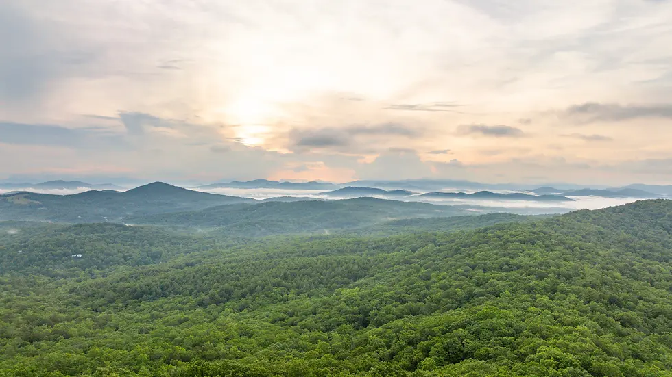
Fall Branch Falls is a multi-tiered double waterfall flowing along Fall Branch Creek within the Chattahoochee National Forest, accessed via the Benton MacKaye Trail near Cherry Log, Georgia. The falls sit roughly 10 miles south of Blue Ridge, GA, making the trailhead one of the most approachable waterfall destinations in the North Georgia mountains without requiring serious hiking fitness or technical gear. What separates Fall Branch Falls from other short waterfall hikes in the region is the combination of scale, forest character, and trail context: the Benton MacKaye Trail (BMT) is a 300-plus mile long-distance trail running from Springer Mountain, Georgia, all the way to Great Smoky Mountains National Park, and this short spur puts you directly on that storied footpath.
The forest surrounding the trail is genuinely beautiful in a way that rewards slower walkers. Soft green moss carpets the rocks along Fall Branch Creek. Mountain laurel and rhododendron crowd the creek bank. The tree canopy is dense enough that midday sun only reaches the trail in patches, which means the walk stays comfortable even in summer heat. A wooden observation deck at the base of the falls provides a clear sightline to both tiers without requiring you to scramble on wet rock.
At The Soaring Eagle GA, a luxury mountain cabin perched at nearly 2,700 feet in Morganton, Georgia, guests regularly ask about waterfall hikes within a reasonable drive. Fall Branch Falls fits perfectly for a morning excursion. The cabin sits approximately 22.5 miles from the Blue Ridge Mountains area, and the Stanley Creek Road trailhead is reachable in under an hour. You can hike, spend time at the observation deck, and be back at the cabin's wraparound deck with coffee before noon. The Space at Soaring Eagle GA is designed with exactly this kind of mountain morning in mind.

How Long of a Hike Is Fall Branch Falls?
Fall Branch Falls is approximately 0.5 miles round trip, with the one-way distance to the falls measuring roughly 0.25 miles from the trailhead. Most hikers complete the round trip in about 30 minutes at a comfortable pace. That said, do not let the short distance mislead you: the trail climbs nearly all the way in, with roots, rocks, and several switchbacks that make the ascent feel more demanding than the mileage suggests.
The Benton MacKaye Trail Association and trail documentation consistently rate Fall Branch Falls as easy to moderate. The incline is the main challenge. Coming back down feels noticeably easier than going up, and the switchbacks are well-marked with white diamond-shaped BMT blazes so navigation is straightforward. The trail surface is natural dirt with exposed roots and embedded rocks throughout, which means trail shoes or light hiking boots are a better choice than sneakers.
For hikers who want more mileage, a 2.8-mile loop option exists that incorporates the falls and continues along the Benton MacKaye Trail. Trail documentation from local sources mentions this loop, though it receives far less coverage than the short spur to the falls. The loop passes an old cemetery accessible via the trail beyond the falls, which adds a layer of historical interest to an already scenic outing. If you plan to take the loop, carry water and budget an additional 90 to 120 minutes beyond the standard 30-minute round trip. For more Outdoor Activities inspiration in the Blue Ridge region, the full trail network offers options for every fitness level. Hikers who enjoy varied terrain may also appreciate the Sawnee Mountain Trail Guide: Beginner to Advanced Hiking for planning other Georgia mountain outings.
Is Fall Branch Falls Kid Friendly?
Fall Branch Falls is reasonably kid-friendly for children who are comfortable walking on uneven, rooty terrain and can manage a steady uphill grade for a quarter mile. The short distance (0.5 miles round trip) means even young hikers can finish without exhaustion. The wooden observation deck at the base of the falls is the key family-friendly feature: it provides a safe, stable viewing platform so kids can see the waterfall clearly without parents worrying about wet rock scrambling near the water's edge.
The main caveat for families is the trail surface itself. The route includes exposed roots, embedded rocks, and several switchbacks with uneven footing. Toddlers in carriers will be fine. Independent walkers aged five and up who are used to trail walking should handle it without issue. Strollers are not suitable for this trail.
The U.S. Forest Service has issued a formal safety alert specifically addressing waterfall climbing at this location. The USFS alert about the dangers of climbing on waterfalls in Chattahoochee National Forest explains that off-trail bank climbing erodes soil, damages tree roots, and can eventually cause trees to fall across the waterfall itself. For families especially, staying on the designated trail and using the observation deck is both the safer choice and the responsible one.
Families planning a broader North Georgia mountain trip will find that Blue Ridge Mountain activities for every type of traveler range from easy waterfall walks like this one to longer ridge hikes, giving you flexibility to match the day's energy level to the right outing. The The Complete Guide to Outdoor Activities for Every Skill Level is another helpful resource for planning your itinerary. Families traveling with dogs will also want to browse Pet Friendly Cabins In The Smoky Mountains for lodging options that welcome every member of the group.

How Do You Get to Fall Branch Falls from Blue Ridge, GA?
Fall Branch Falls is accessed via Stanley Creek Road near Cherry Log, Georgia, approximately 10 miles south of downtown Blue Ridge. The USFS official trailhead page for Fall Branch Falls confirms the parking area and trailhead location. GPS coordinates for the trailhead are 34.784000, -84.302167 (N34 47.040 W84 18.130). Parking is free at the U.S. Forest Service trailhead, and the access road is gravel.
From downtown Blue Ridge, the most straightforward north approach follows GA-515 South toward Cherry Log and then turns onto Stanley Creek Road. The road involves curves and some elevation change but is navigable in a standard passenger vehicle from this direction. Most sedans and SUVs handle the north approach without difficulty.
The south approach is a different story. Comments from hikers familiar with the area warn that the south approach road is rough, washed-out in sections, and includes blind curves that genuinely require a truck or Jeep with clearance. If you are driving a low-clearance sedan, use the north approach from Blue Ridge and add the extra driving time rather than risking the south route. This is the kind of logistical detail that most trail guides skip, but it matters considerably if you arrive from the wrong direction.
From The Soaring Eagle GA cabin in Morganton, the most practical route heads north toward Blue Ridge on US-19/129 before connecting south toward Cherry Log. The full drive time from Morganton to the trailhead runs approximately 40 to 50 minutes depending on your specific route. Plan to arrive early on weekends. The small trailhead parking area fills quickly during peak season, and the shoulder of Stanley Creek Road has limited overflow capacity. For more on planning a stay near the trailhead, Where to Stay in the Blue Ridge Mountains: The Complete Planning Guide covers the full range of lodging options in the area. Those interested in waterfront retreats close to the trailhead area can also explore toccoa river cabin rentals as a nearby base option.
What Is the Prettiest Section of the Blue Ridge Parkway?
The Blue Ridge Parkway, managed by the Blue Ridge Parkway National Park Service, stretches 469 miles from Shenandoah National Park in Virginia to the Oconee River in North Carolina, and the most consistently celebrated scenic section runs through the North Carolina highlands between Asheville and the Linn Cove Viaduct near Grandfather Mountain. This 30-mile stretch combines sweeping valley panoramas, the famous curved concrete viaduct hugging the face of Grandfather Mountain, and open meadow overlooks that are particularly striking during October foliage. The Linn Cove Viaduct alone, completed in 1987 after years of construction to protect the fragile geology of Grandfather Mountain, is an engineering landmark and one of the most photographed roadway structures in the Southeast.
For visitors based near Blue Ridge, Georgia, though, the most accessible and relevant stretch of the parkway experience comes through the Chattahoochee National Forest trail network rather than the parkway itself, which begins further north in North Carolina. Fall Branch Falls sits within this forest, and the surrounding ridgelines offer the same quality of mountain scenery that draws visitors to the parkway's Virginia and North Carolina sections.
If you want true parkway access during a North Georgia cabin trip, the closest practical entry point is roughly 90 to 120 minutes north into North Carolina. A day trip built around the Waterrock Knob overlook near Waynesville, NC, consistently ranks among the top parkway experiences for views. For Blue Ridge Mountain hikes ranked by breathtaking views, the North Georgia options closer to the cabin deliver comparable scenery without the parkway drive time. The The Complete Travel Guide to North Georgia's Blue Ridge Mountains offers additional context for planning a multi-day itinerary around these destinations. You can also check Blue Ridge Parkway fall color webcams to time your visit around peak foliage conditions along the parkway. Visitors who want to explore the broader region by road will find useful starting points in 8 Blue Ridge Parkway Cabin Locations That Put You Minutes From Iconic Drives.
What Is the Best Season to Visit Fall Branch Falls?
Fall Branch Falls is accessible year-round, but each season offers a genuinely different experience worth planning around. Spring, specifically late March through May, delivers the strongest water flow as snowmelt and seasonal rain feed Fall Branch Creek. The rhododendron along the creek bank typically blooms in late May through June, creating a tunnel of white and pink flowers overhead on the approach. This combination of high water volume and flowering mountain laurel makes late spring arguably the most visually rewarding time to visit.
October is the obvious choice for fall foliage, and for good reason. The hardwood canopy surrounding the Benton MacKaye Trail corridor turns in earnest during the second and third weeks of October, with red maples and golden hickories lighting up the ridgelines above the creek drainage. Water levels in fall tend to be lower than spring, which means the waterfall may appear less dramatic, but the surrounding forest color more than compensates. Weekly fall color updates from regional sources can help you time a visit to the peak week rather than guessing. Timing your cabin stay around peak foliage is covered in detail in When To Visit The Blue Ridge Parkway Insider Tips For Every Season And Fewer Crowds.
Summer is viable but comes with heat, humidity, and the highest trail traffic of any season. Go before 9 AM if visiting in July or August. The dense canopy keeps the trail shaded, but the observation deck area can feel humid without a breeze. Winter visits are genuinely underrated: cold snaps occasionally create ice formations along the falls face, and the bare hardwood canopy opens up long-distance views through the forest that summer foliage obscures entirely. Check road conditions before a winter visit, as the Stanley Creek Road access can become icy after storms. After a winter hike, warming up in one of the area's Georgia's most romantic log cabin getaways with hot tubs is a perfect way to end the day. Anglers visiting in spring or fall may also want to look into a fishing cabin in the area to combine a waterfall hike with time on the water.

Photography Tips for Fall Branch Falls: Best Angles and Lighting
Waterfall photography at Fall Branch Falls rewards patience more than equipment. The wooden observation deck at the base of the falls is your primary shooting position, and it frames both tiers of the double cascade cleanly from a stable, level platform. The biggest lighting challenge is the dense canopy overhead: direct sun reaching the falls only occurs in limited windows depending on the season, and harsh midday light creates blown-out highlights on the white water against dark rock. Early morning arrivals, roughly 7 to 9 AM, deliver the softest, most diffuse light for fall waterfall photography throughout most of the year. For a broader look at shooting waterfalls across the region, Waterfall Hikes of North Georgia: Trail Conditions, Fees & Photo Tips covers additional locations and technique tips.
For the classic long-exposure waterfall look, a tripod is useful but the deck railing can serve as a stabilizer in a pinch. Aim for a shutter speed between 1/4 and 1 full second to smooth the water without eliminating all texture. Overcast days are not disappointing here: flat cloud cover acts as a natural diffuser and eliminates the contrast problem that bright sun creates. Some of the best waterfall shots from this location come on light-rain days when the creek runs high and the moss turns a deeper, more saturated green.
Turn left after descending the observation deck steps and follow the Benton MacKaye Trail sign if you want to photograph the top of the falls from above. This angle shows the plunge from a completely different perspective and is worth the extra few minutes. Note one honest caveat: a glamping development noted by locals as installed on the valley wall to the right of the falls does appear in some viewing angles from the deck. Composing your shots to the left or straight ahead minimizes this intrusion in the frame.
What Gear Should You Bring to Fall Branch Falls?
Fall Branch Falls requires minimal gear given the 0.5-mile round trip distance, but a few specific items make the experience noticeably better. Trail shoes or light hiking boots with grip are the most important choice: the trail surface combines natural dirt, embedded rocks, and exposed tree roots, and wet conditions (common near waterfalls) make the descent slippery. Athletic sneakers work in dry conditions but become a liability after rain.
Bring at least one liter of water per person. The hike is short but the uphill grade on the way in raises your heart rate enough to make hydration relevant, especially in warm months. Trekking poles are optional but genuinely useful for the descent, particularly if you are bringing young children or have knee concerns.
For navigation, the trail is well-marked with white diamond-shaped BMT blazes and is difficult to lose. That said, the Trailful Outdoor Co. hiking outfitter in Hiawassee, GA, stocks the Nat Geo 777 Trails Illustrated Map specifically recommended for navigating this section of the Chattahoochee National Forest. If you plan to extend the hike to the full 2.8-mile loop or explore beyond the falls to the old cemetery section of the BMT, a physical map is a smart addition to your pack. Cell service along Stanley Creek Road and near the trailhead is unreliable, so do not count on live navigation apps once you leave the main road.
If you are using the hike as a warm-up for a broader North Georgia outdoor trip, the team at Benton MacKaye Trail Association maintains volunteer resources and trail condition updates for the BMT corridor. Supporting their work through donations helps keep this trail and others like it in good condition for future visitors.
What Other Waterfall Hikes Are Near Fall Branch Falls?
Fall Branch Falls sits within a cluster of short to moderate waterfall hikes along the Benton MacKaye Trail and the Appalachian Trail corridor in North Georgia, making it a natural anchor point for a full waterfall-focused day trip. The most frequently cited companion hike is the Toccoa River Swinging Bridge, also accessible via the Benton MacKaye Trail, at approximately 0.5 miles round trip. The swinging bridge itself spans the Toccoa River and offers a unique physical experience beyond a standard viewpoint: the bridge sways noticeably underfoot, and the river view from the center is one of the quieter, less-visited scenic spots on the BMT. Fans of toccoa river cabin rentals often combine this bridge visit with the Fall Branch Falls hike in a single morning.
Further afield, Long Creek Falls and Three Forks are both mentioned as nearby waterfall destinations on the Appalachian Trail near Springer Mountain. Long Creek Falls is accessed from the Three Forks trailhead and involves a slightly longer walk than Fall Branch, but the payoff is a tall, narrow falls with excellent swimming access in summer months. Three Forks itself is a trail confluence point where three creeks merge, and the surrounding flat camping area makes it a popular overnight destination for AT section hikers.
For practical planning purposes: combining Fall Branch Falls and the Toccoa River Swinging Bridge in a single morning is straightforward since both are short. Adding Long Creek Falls turns the outing into a full day. The Atlanta Trails interactive map provides a useful planning view of how these hikes cluster relative to each other in the North Georgia mountains.
Where Should You Stay When Visiting Fall Branch Falls Near Blue Ridge?
Fall Branch Falls is a half-day hike, which means your lodging choice affects how much you can pack into the surrounding days. Blue Ridge, Georgia, is the closest town with a range of dining, shopping, and overnight options, and most visitors treat the falls as one stop on a broader North Georgia mountain itinerary. For couples, small families, and pet travelers who want a true mountain base rather than a downtown hotel room, a cabin rental puts you closer to both the falls and the broader outdoor landscape. Browse Best Cabin Rentals: From Budget-Friendly to Luxury Mountain Retreats for a full comparison of what the region offers across price points. Hikers looking for additional lodging options can also explore where to stay in Morganton, GA for a broader overview of the area. For a handpicked selection of standout properties, 15 Enchanting Cabins In Blue Ridge Mountains Ga That Feel Pure Magic highlights some of the most memorable stays in the region. Those who prefer to compare curated options across the area can also browse Blue Ridge For Rent Premium Mountain Cabins And Local Insights for premium properties with local context.
Soaring Eagle GA is a two-bedroom, 2.5-bath luxury cabin perched at nearly 2,700 feet in Morganton, Georgia, and it earns its reputation as one of the more thoughtfully designed cabin stays in the Blue Ridge area. The wraparound deck faces the mountain ridgeline with views that stretch for miles on clear mornings. After a waterfall hike, the hot tub with its scenic overlook is exactly where you want to spend the early evening. Two king bedrooms, two nostalgic arcade games for rainy afternoons, a wood-burning fireplace, and a fully stocked kitchen round out the practical checklist. The cabin is genuinely pet-friendly with no breed restrictions, which matters if you are bringing a dog on the trail with you. Travelers who love soaking in mountain views from a hot tub will find detailed comparisons in Blue Ridge Cabin Rentals With Hot Tub Peak Season Guide 2026.
The Blue Ridge mountain cabin rental market has grown steadily, with AirDNA data showing the Morganton area at an average daily rate of roughly $320 as of 2026, and 633 active listings across the region. Soaring Eagle GA positions itself at the premium end of that market with verified mountain views and a new hot tub rather than the dated amenities that pad out many mid-tier rentals. For Blue Ridge Mountain vacation rentals that consistently deliver, the combination of elevation, views, and post-hike amenities at this cabin is a strong match for hikers who want comfort after a day on the trail. Travelers planning ahead can also find curated picks among North Georgia cabin rentals and luxury mountain retreats for every season. For those ready to reserve, Book directly through Soaring Eagle GA to secure the best available rate.
The cabin is also a practical base for the area's cabin with hot tub Blue Ridge Mountains search intent: the hot tub sits at the corner of the deck where the mountain view is widest, and on clear nights the low light pollution at 2,700 feet makes star visibility exceptional.
Frequently Asked Questions About Fall Branch Falls Near Blue Ridge, GA
How long of a hike is Fall Branch Falls?
Fall Branch Falls is approximately 0.5 miles round trip, with the one-way distance measuring roughly 0.25 miles from the trailhead to the observation deck at the base of the falls. Most hikers complete the full round trip in about 30 minutes at a comfortable pace. The trail climbs steadily on the way in, with roots, rocks, and several switchbacks that make the difficulty rating easy to moderate despite the short distance.
How long is the hike to Fern Branch Falls?
Fern Branch Falls refers to a different waterfall located in the Great Smoky Mountains National Park in Tennessee, not the Chattahoochee National Forest near Blue Ridge, Georgia. The hike to Fern Branch Falls in the Smokies is approximately 5.4 miles round trip via the Porters Creek Trail and is rated moderate in difficulty. Fall Branch Falls near Blue Ridge, GA, is a completely separate waterfall and should not be confused with the Smoky Mountain version.
Is Fall Branch Falls kid friendly?
Fall Branch Falls is reasonably kid-friendly for children who can walk on uneven, rooty trail surfaces and manage a steady uphill grade for about a quarter mile. The wooden observation deck at the base of the falls provides a safe, stable viewing platform. Toddlers carried in hiking packs will do fine. Independent walkers aged five and up who are experienced on trails should manage the hike without difficulty. Strollers are not appropriate for this trail surface.
Is Fall Branch Falls dog-friendly?
Yes, Fall Branch Falls on the Benton MacKaye Trail is dog-friendly. Dogs are allowed on the trail but must be kept on leash throughout. The trail environment includes creek access points that dogs tend to enjoy, and the short distance makes the outing comfortable for most dogs. Bring water for your pet, as the trailhead does not have dedicated dog water stations. For dog-friendly lodging nearby, Dog Friendly Vacation Rentals Trail Ready Included Georgia covers the best options in the region.
What is the prettiest section of the Blue Ridge Parkway?
The most consistently praised scenic section of the Blue Ridge Parkway runs through the North Carolina highlands between Asheville and the Linn Cove Viaduct near Grandfather Mountain, a stretch of roughly 30 miles. The Linn Cove Viaduct itself, a curved concrete engineering landmark completed in 1987, is one of the most photographed road structures in the Southeast. For visitors based near Blue Ridge, Georgia, this section of the parkway requires a 90 to 120 minute drive north into North Carolina.
Is it safe to climb on Fall Branch Falls?
No. The U.S. Forest Service has issued an official safety alert specifically warning hikers not to climb on Fall Branch Falls or the surrounding banks. Off-trail climbing erodes soil, damages tree root systems, and can eventually cause trees to fall across the waterfall. The wooden observation deck at the base of the falls provides excellent viewing access without requiring any scrambling on wet rock. Stay on the designated trail and use the deck.
What is the Benton MacKaye Trail?
The Benton MacKaye Trail is a 300-plus mile long-distance hiking trail that begins at Springer Mountain, Georgia, the southern terminus of the Appalachian Trail, and runs north to Great Smoky Mountains National Park in Tennessee. Fall Branch Falls sits directly on the BMT and is one of the most accessible and scenic short day hikes along the trail's southern Georgia section. The trail is maintained by the Benton MacKaye Trail Association, a volunteer organization that welcomes donations and volunteer day participation.
What is the best time of year to visit Fall Branch Falls?
Late spring (late March through May) offers the highest water volume and rhododendron blooming season, making it the most visually dramatic period. October delivers peak fall foliage around the trail. Summer visits are comfortable thanks to the dense shade canopy but bring heavy weekend foot traffic; arriving before 9 AM avoids the worst of the crowds. Winter visits are underrated, as cold snaps can produce ice formations on the falls face and the bare canopy opens up forest views otherwise blocked by summer foliage. For seasonal planning help, Blue Ridge Mountain Rentals: Your Seasonal Planning Guide for 2026 outlines the best times to visit across all four seasons.
Plan Your Trip: The Essentials Before You Go
A few practical details will save you frustration on the day of your visit to Fall Branch Falls. The trailhead parking area is small. On summer and October weekends, it fills by mid-morning. Arriving by 8 AM gives you a comfortable margin. The Stanley Creek Road access involves gravel road driving regardless of which direction you approach from; use the north approach from Blue Ridge if you are in a standard passenger vehicle and save the south approach for those in a truck or high-clearance SUV.
There are no restrooms at the trailhead. Plan accordingly before you leave Blue Ridge or wherever you are based. Cell service along Stanley Creek Road is unreliable, so download an offline map or screenshot the GPS coordinates (34.784000, -84.302167) before you lose signal. The Atlanta Trails interactive map works well for pre-trip planning from your phone or desktop before you head out.
For the longer 2.8-mile loop option, the trail continues past the falls along the Benton MacKaye Trail and passes an old cemetery before looping back. This section of trail receives less maintenance attention than the main falls spur, so conditions vary more by season. Carry water for the full loop, as there are no facilities or guaranteed water sources beyond the creek itself (which requires treatment before drinking). Trekking poles are a genuine asset on this route, particularly on any wet-season descent.
The things to do in Morganton, Georgia guide covers additional day trip options, including Amicalola Falls State Park (14.2 miles from the cabin, about 28 minutes) and the Appalachian Trail access at Springer Mountain (16.8 miles, about 32 minutes). Pairing Fall Branch Falls with one of these destinations makes for a full and satisfying outdoor day in the North Georgia mountains. The Best Things to Do Near Morganton, GA: The Complete 2026 Guide is a useful companion resource for building out your full itinerary. After a long day on the trail, explore Dining & Food in Morganton GA: The Complete Local Guide to find satisfying post-hike meal options nearby. For a curated list of local favorites that go beyond the typical tourist spots, Worth The Drive 15 Morganton Restaurants That Beat Blue Ridge Tourist Traps is an excellent resource. Visitors who want to browse the full range of dining options in the broader area will find Restaurants And Dining In Morganton Ga a helpful reference before heading out.
Final Thoughts: Is Fall Branch Falls Worth the Drive from Blue Ridge?
Fall Branch Falls is absolutely worth the drive. The 0.5-mile round trip distance makes it one of the most accessible waterfall hikes in the Chattahoochee National Forest, and the double-cascade format means the payoff feels bigger than the effort required. The Benton MacKaye Trail context adds depth for hikers who care about where their trails connect. The forest environment, with its moss-covered rocks, rhododendron canopy, and large-trunked hardwoods, is genuinely beautiful rather than merely adequate.
The honest caveats: the trailhead parking fills fast on weekends, the south approach road requires a capable vehicle, and the short distance means serious hikers will want to pair this with a second hike or extend onto the 2.8-mile loop. None of those caveats diminish the core experience. For families, couples, and dog owners based in the Blue Ridge area in 2026, Fall Branch Falls delivers a complete waterfall experience in under an hour of round-trip hiking time. For more Blue Ridge Hidden Gems Locals Actually Keep to Themselves, the surrounding Chattahoochee National Forest has no shortage of rewarding discoveries. Visitors seeking a curated overview of the region's top lodging can also browse 12 Blue Ridge Mountain Cabin Rentals In Georgia You Need To Book for well-reviewed options across the area. Those who want even more options can find inspiration in Hidden Mountain Retreats 10 Best Blue Ridge Cabin Rentals In Georgia for standout properties throughout the region.
Whether you're chasing waterfalls or simply looking for a place to reconnect with mountain air, the North Georgia forest around Cherry Log and Blue Ridge delivers. Fall Branch Falls, sitting quietly on one of Georgia's great long-distance trails, is the kind of place that rewards a return visit in every season.

After a morning at Fall Branch Falls, Soaring Eagle GA puts you within comfortable driving distance of the trailhead while giving you something worth coming back to. The hot tub on the wraparound deck, positioned to face the mountain ridgeline at nearly 2,700 feet in Morganton, is where the day's hike properly ends. Check availability at this Blue Ridge Mountains cabin with hot tub and plan your North Georgia waterfall trip around a base that earns its keep after the trail shoes come off.


Comments